| Radio Signal and Triangulation |
Untitled Document
⊕
Triangulation
♦
a wireless device calculates its own locations based on the
signal attenuations and transmitter locations.
利用測量無線電強度來估計待測點與至少三個已知位置的無線電發射器之間
的距離,再利用三角定位法計算得到待測點的位置。
⊕
RadioMap
♦
a wireless device compares the measured radio signals to the
prerecorded radio signals to determine its own location
Untitled Document
⊕
Triangulation by Propagation Model
♦
Use propagation model to do the triangulation
♦
a wireless device calculates its own locations based on the
signal attenuations and transmitter locations.
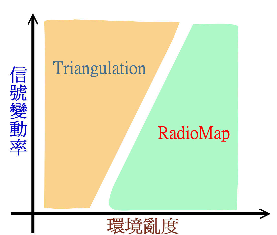
| Pros
| Cons
- Low human labor cost
(Only need to know the locations of reference points and
their signal strengths.)
- Only sensitive to environment change
| Sensitive to signal interference
(inaccurate if signals are interfered)
| |
Untitled Document
⊕
Patten Match by Radio Map
♦
a wireless device compares the measured radio signals to the
prerecorded radio signals to determine its own location
| Training Phase
| Measure radio signals of every location to make a map of radio signals
| Execution Phase
| Measure radio signals of the current location and
compare to the radio map to determine its own location
| |
| Pros
| Cons
|
Insensitive to signal interference
|
- High human labor cost
- Sensitive to both environment change and signal change
| |
Untitled Document
Untitled Document
♦
使用 Radiomap 方式雖然很有效,但是需要耗費大量人力物力去測量各地的
無線電信號,並製作成信號地圖,才能使用。
如果無線電發射源如果有任何變動,則定位精確度將大幅下降,
因而必須重新耗費大量人力製作信號地圖。因此,在某些情況下,並不適用。
♦
另一個方式,是與 GPS類似,利用WLAN的無線電信號測量距離,再運用三角定位
法求出待測點的位置,如果信號源有任何變動,只需更動定位軟體所使用參考點
的工程參數即可。可惜的是,無線電信號受到地形的影響,所測量到的距離誤差
可能很大,這個定位方法如果沒有特殊修正,遠不如 Radiomap精確。
⊕
When to use Phantom Positioning
♦
幻影式定位法,可以提高三角定位法的精確度,使得原來很多只能用
Radiomap 定位法的情況,可以改用較省人力的三角定位法。
 Untitled Document
⊕
測量距離之方法有多種,
♦
其中利用無線電波的特性是最為方便的測量工具。
⊕
By Radio Traveling Time
♦
利用無線電波行進速度恆定的特性,測量從發射源到達接收點的電波傳遞
時間再換算成距離。
此種方法目前最為方便且最為風行,但是待測點與衛星之間不能有障礙,
因此無法在室內使用,也容易有死角,設備也較貴。
⊕
By Signal Strength Attenuation 利用電波強度換算成距離
♦
無線電自發射源發射之後隨著距離增加而衰減,在
沒有障礙沒有反射物的理想情況下,無線電波的強度之衰減與距離成
一個穩定的數學關係。
換言之,比較發射強度與接收點的強度即可反推而得發射源與接收器之間的距離。
Untitled Document
|
Radio Signal and Triangulation
|
|---|
Untitled Document
♦
本技術利用虛擬發射源的位置取代實際發射源的位置,在利用「無線電強度三角定位法」
時可以得到更高的精確度。在實際實施時,必須事先針對每一個發射源測量各接收點的強
度並計算得到虛擬發射源的位置方能使用本項技術。